Topographic map of the municipality of Baarle-Nassau, June 2015
Baarle-Nassau (Dutch pronunciation:[ˌbaːrləˈnɑsʌu]ⓘ) is a municipality and town in the southern Netherlands, located in the province of North Brabant. It had a population of 6,899 in 2019[update]. The town is the site of a complicated borderline between Belgium and the Netherlands: it encloses 22 small exclaves of the Belgian town Baarle-Hertog, of which the two largest contain seven counter-enclaves of Baarle-Nassau, and the main body of Belgium contains another.
Geography
The border with Baarle-Hertog, Belgium
Baarle-Nassau is closely linked, with complicated borders, to the Belgian exclaves of Baarle-Hertog. Baarle-Hertog consists of 26 separate parcels of land. Apart from the main parcel, known as Zondereigen and located north of the Belgian town of Merksplas, there are 22 Belgian exclaves in the Netherlands and three other parcels on the Dutch-Belgian border. There are also six Dutch exclaves located within the largest Belgian exclave, one within the second-largest, and an eighth within Zondereigen. The smallest Belgian parcel, H7, locally named De Loversche Akkers, measures 2,469 square metres (26,580 sq ft).
The border's complexity results from numerous medieval treaties, agreements, land-swaps and sales between the Lords of Breda and the Dukes of Brabant. Generally speaking, predominantly agricultural or built environments became constituents of Brabant, while other parts devolved to Breda. These distributions were ratified and clarified as a part of the borderline settlements arrived at during the Treaty of Maastricht in 1843.
For clarification and the interest of tourists, the border is made visible on all streets with iron pins. This way it is always clear whether one is in Belgium (Baarle-Hertog) or in the Netherlands (Baarle-Nassau). This is also visible on the house numbers: the style of house numbers is different in both countries, and often one will find the Dutch or Belgian flag next to the number.
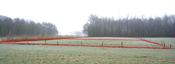
Belgian and Dutch territory in Baarle-NassauBorder between Netherlands and Belgium in Baarle-Nassau.
Counter-enclave surrounded by Belgian exclave H1, in Baarle-Hertog; contains a mix of dwellings and farmland; boundary of N1 and H1 runs through one building.
N2, De Tommelsche Akkers
1.3751
3.3981
Counter-enclave surrounded by Belgian exclave H1, in Baarle-Hertog; contains 8 dwellings.
N3, De Tommelsche Akkers
0.2863
0.7075
Counter-enclave surrounded by Belgian exclave H1, in Baarle-Hertog; boundary of N3 and H1 bisects the loading dock of a liquor store.
N4, De Rethsche Akkers
1.2324
3.0454
Counter-enclave surrounded by Belgian exclave H1, in Baarle-Hertog; boundary of N4 and H1 runs through a warehouse, with vacant Dutch land to the rear of the warehouse.
N5, De Rethsche Akkers
1.9212
4.7475
Counter-enclave surrounded by Belgian exclave H1, in Baarle-Hertog; boundary of N5 and H1 runs through a furniture showroom, a shed and a barn.
N6, Gierle Straat
1.4527
3.5898
Counter-enclave surrounded by Belgian exclave H1, in Baarle-Hertog; consists of farmland with two buildings.
N7, De Kastelein
0.5812
1.4363
Counter-enclave surrounded by Belgian Oordeel exclave H8, in Baarle-Hertog; occupies part of a field.
N8, Vossenberg
2.8528
7.0496
Farmland enclave situated within Zondereigen, Belgium, less than 50 meters south of the Dutch border.
Belgian enclaves
These are all part of Baarle-Hertog municipality, and are surrounded by Baarle-Nassau municipality (Netherlands).
H1, Aen het Klooster Straetje - Hoofdbraek - Loveren - De Boschcovensche Akkers - De Loversche Akkers - De Tommelsche Akkers - De Tommel - De Gierle Straat - De Reth - De Rethsche Akkers - Het Dorp - De Kapel Akkers - De Kastelein
153.6448
379.6717
Forms a quadripoint with enclave H2; largest Belgian exclave; encompasses six Dutch enclaves; consists of dwellings for the most part, with outlying farmland and an industrial area; boundary runs through numerous buildings; contains a portion of the former Turnhout-Tilburg rail line, now a cycle path.
H2, De Rethsche Akkers
2.4116
5.9594
Consists of farmland with a single point of connection (quadripoint) between enclaves H1 and H2 in the middle of a corn field.
H3, De Rethsche Akkers
0.3428
0.8471
Occupies part of a field; boundary runs through a shed in one instance.
H4, De Rethsche Akkers
1.476
3.6474
Consists of farmland; boundary runs through a house and three sheds.
H5, De Kapel Akkers
0.9245
2.2846
Consists of farmland with a dwelling.
H6, Hoofdbraek
1.7461
4.3148
Mixed land usage; boundary runs through a warehouse/factory.
H7, De Loversche Akkers
0.2469
0.6102
Boundary runs through two dwellings, including the middle of one front door (giving it two house numbers: Loveren 2, Baarle-Hertog / Loveren 19, Baarle-Nassau).
H8, Boschcoven - De Kastelein - De Oordelsche Straat
41.8781
103.485
Second-largest Belgian exclave, contains a mix of dwellings and farmland; boundary runs through a barn, a dwelling and two businesses.
H9, De Kapel Akkers
0.4005
0.9897
Boundary runs through a printing factory/warehouse in an industrial area.
H10, De Oordelsche Straat
0.65
1.6063
Consists of farmland.
H11, De Oordelsche Straat
0.93
2.2982
Consists of farmland.
H12, Boschcoven
0.2822
0.6974
Consists of farmland.
H13, Boschcoven
1.5346
3.7922
Boundary runs through about 20 dwellings.
H14, Boschcoven
0.7193
1.7774
Boundary runs through about 13 dwellings.
H15, Boschcoven
1.7211
4.2531
Boundary runs through about 16 dwellings.
H16, Keizershoek - Oordelsche Straat
4.4252
10.9352
Boundary runs through a house and three sheds, with the linear boundary changing direction three times inside just one shed.
H17, Moleriet Heide
14.9248
36.8807
Rural area containing a portion of the former Turnhout-Tilburg rail line, now a cycle path.
H18, De Manke Gooren
2.9247
7.2273
Consists of farmland.
H19, De Peruiters
0.6851
1.693
Consists of several ponds and a field.
H20, Wurstenbosch - Vossenberg
1.1681
2.8865
Consists of farmland.
H21, Baelbrugsche Beemden
1.1845
2.9271
Consists of farmland.
H22, De Wit Hagen
0.2632
0.6504
South of the village of Ulicoten; occupies part of a field; nationality was contested from the 1830s until 1995 (remained unallocated to either country in boundary treaty of 26 April 1974)
^ abWhyte, Brendan (2004). "En Territoire Belge et à Quarante Centimètres de la Frontière" An historical and documentary study of the Belgian and Dutch enclaves of Baarle-Hertog and Baarle-Nassau. The University of Melbourne, School of Anthropology, Geography and Environmental Studies. ISBN0-7340-3032-0.
^"Jeugd en Onderwijs". Baarle-Nassau. Retrieved 2022-01-18. - Under the tab "Onderwijs en kinderopvang"
^"bibliotheek." Baarle-Hertog. Retrieved on January 6, 2017.
External links
Wikimedia Commons has media related to Baarle-Nassau.


.svg)


